Kenta-san's Travel Bookmarks
| 8:00 | Breakfast at the inn "Shimpuro" |
|---|---|
| 9:00 | Start of the ride |
| 9:40 | Stop at the sightseeing boat pier in Ine Town |
| 12:00 | Rest at the roadside station "Tenki Tenki Tango" |
| 12:45 | Lunch at the "Tento Mushi Batake" restaurant |
| 15:45 | Cross the Yosa Pass into Fukuchiyama City |
| 16:30 | Goal at Fukuchiyama Station |
| 17:49 | Take the limited express “Kinosaki” to Kyoto Station |
| 19:07 | Arrive at Kyoto Station |
| 19:21 | Take the Shinkansen Nozomi to Tokyo |
| 21:33 | Arrive at Tokyo Station |
DAY 2 is over!
ride up and down!

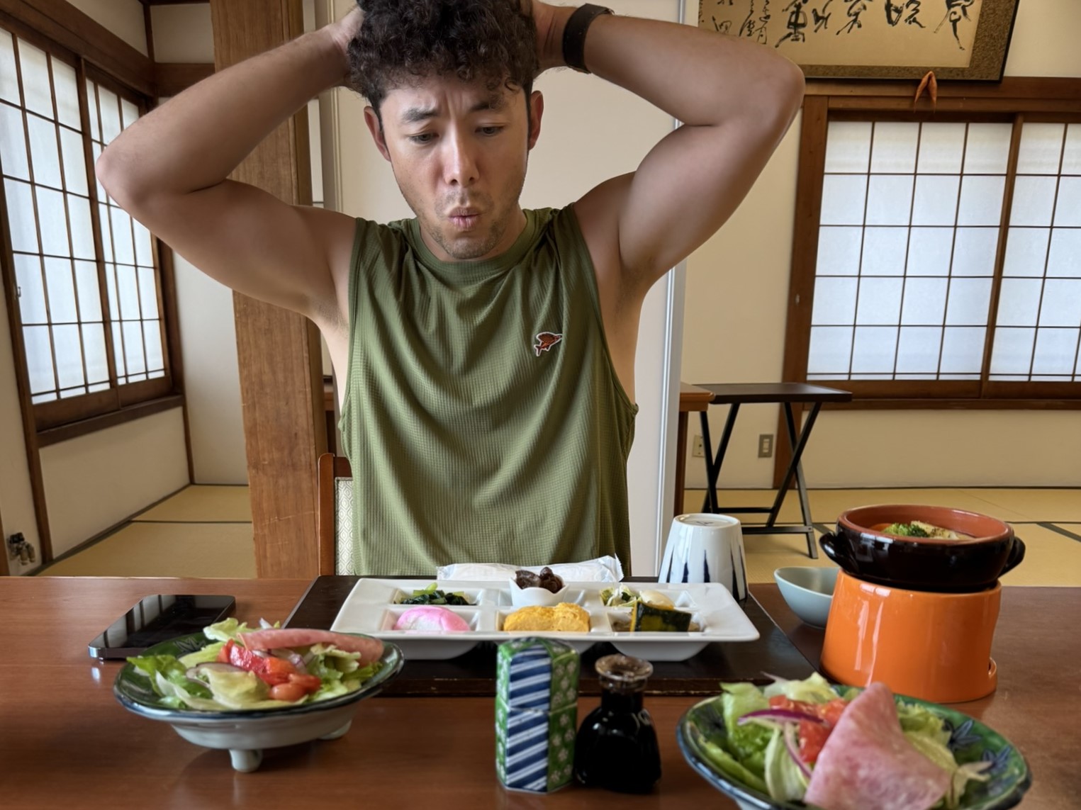
Breakfast at the inn "Shimpuro"
We had breakfast at the inn on the second day. The menu included healthy Japanese dishes such as local vegetable salads and pickles.
As we would be riding 100km that day, we decided to also have a second helping of rice to ensure we would get a good supply of energy.

Start of the second day of the ride
After checking out, we stopped by the Motoise Tatsu Shrine next to the inn to pray for safety.
This kago shrine is the home of the Oise-sama, where Amaterasu Omikami and Toyouke Omikami, who are currently enshrined at Ise Jingu, were enshrined before being moved to Ise. The second day of the ride started in the fresh morning air of the most well-known shrine shrine in Tango.

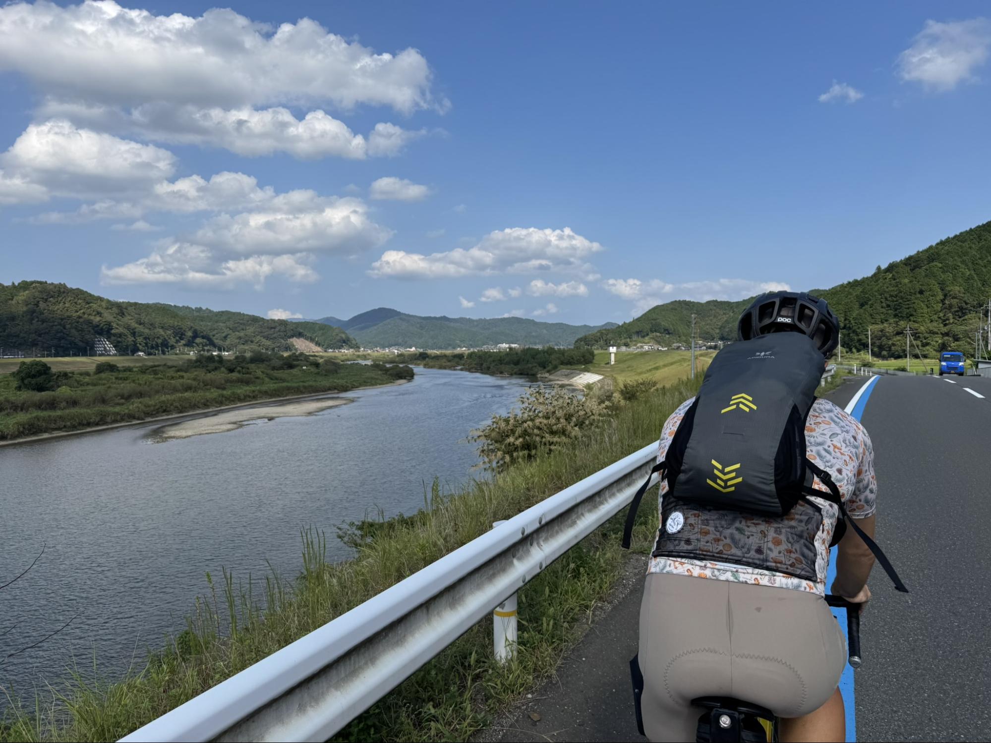
We rode north along National Route 178, looking out over Wakasa Bay from Miyazu City. Then headed to the neighboring town of Ine, which is about 15km away.

Ine Bay Cruise
We heard by word of mouth that the seagulls that gather around the pleasure boats are a sight to behold, so we stopped by the “Ine Bay Pleasure Boat” pier. There were a large number of seagulls gathered above the departing pleasure boat, which was selling kappa shrimp crackers for the seagulls.

I was surprised by the number of seagulls, but I was also surprised by the number of sea urchins on the seabed of Ine Bay (the black blobs in the photo). According to the information I received from a security guard nearby, this was still a low number of sea urchins for the time of year. I wonder if this is due to rising sea water temperatures.

Ine's Boat Houses
After leaving the pier for the pleasure boat, we rode slowly through the fishing town of Ine. On both sides of the road, there were about 230 boat houses lined up. The second floor of the boat houses is the living space, and the first floor is the boat landing. The first floors have a unique structure that is like a boat garage. Some of the houses have been converted into inns, but they are always popular and it is very difficult to make a reservation.

From a little way off, you can see the area where the boat houses are lined up. The scenery of the emerald green sea and the boat houses standing in a row makes you want to stop your bike and take a photo of it.

After leaving Ine Town, we rode along National Route 178 to the northernmost part of Kyoto City, Kyotango City. The Tango Peninsula has a typical ria coastline, with winding roads that continue to rise and fall.

Roadside Station "Tenkitenki Tango"
Despite it being early October, the day's maximum temperature was around 30 degrees celsius. We stopped at a roadside station to rehydrate. The Kotohiki area of Tango is famous for its salt. We quenched our thirst with the local soda ‘Kotohiki no Shio Soda’ and non-alcoholic beer.

Lunch at "Tentoumushibatake"
We had lunch at the organic cafe ‘Tentoumushibatake’ in Kyotango City. This popular restaurant serves dishes made with organic vegetables grown on the premises. The pizza we ordered had a chewy crust and was filled with brightly colored, sweet vegetables. The carefully prepared dishes were also substantial.

After lunch, we were riding when it started to rain. I checked the rain clouds on my smartphone and took shelter in a convenience store. We warmed up our soaked bodies with a hot coffee and took a 15-minute break, waiting for the rain to stop.

Kaye Railway Bicycle Path
After taking shelter from the rain at a convenience store, we cycled for about 20km to the “Kaye Railway Bicycle Path”, which runs through the center of Yosano Town. This private railway line, which was once used to transport ore and other goods and as a local means of transport, was decommissioned, but has since been re-purposed as a 12km-long bicycle path. The scenery of the path cutting through the rice fields is similar to that of the Tsukuba-Kasumigaura Ring Ring Road.

The difficult “Yosa Pass” before the goal
After riding along the cycle path, we rejoined Route 176 again, and the last difficult section before the goal in Fukuchiyama City, “Yosa Pass”, was up ahead. We rode up the 7km long slope and crossed the pass.

Goal at Fukuchiyama Station
After riding through the city for a while, we arrived at Fukuchiyama Station and reached the goal safely. On the second day, the route was about 110km long and we gained 1000m in elevation, so it was a route that was both challenging and rewarding. After reaching the goal, we wanted to relax, but first we had to prepare the bike for transport.

Cheers at "Gyoza no Ousho"
After we had finished packing our bikes, we had some time to spare before the train departed, so we went to Gyoza no Ousho in the station and had a drink! Tsucchi and I enjoyed the scenery of Kyoto by the Sea, including the Yuragawa Bridge, Amanohashidate, one of Japan's three most scenic spots, and the Ine Boat Houses. It takes a little over 5 hours to get there from Tokyo by changing between the Tokaido Shinkansen and limited express trains, but the “Sea of Kyoto” in northern Kyoto can be enjoyed in a two-day, one-night trip, and there are few cars on the roads, so they are clear, clean, and recommended.