Kenta-san's Travel Bookmarks
| 7:45 | Departure from Shimizu Port |
|---|---|
| 9:00 | Arrival at Toi Port |
| 9:15 | Ride Start |
| 10:30 | Toi Pass |
| 11:00 | Bakery&Table Tofuya Ashiyu Cafe |
| 13:15 | Lunch at Volcano |
| 14:15 | Numazu Deep Sea Pudding Factory |
| 16:45 | Trial Park |
| 17:30 | Satta Pass |
| 18:00 | Goal at Shimizu Port |
All done!
are based on
word of mouth.
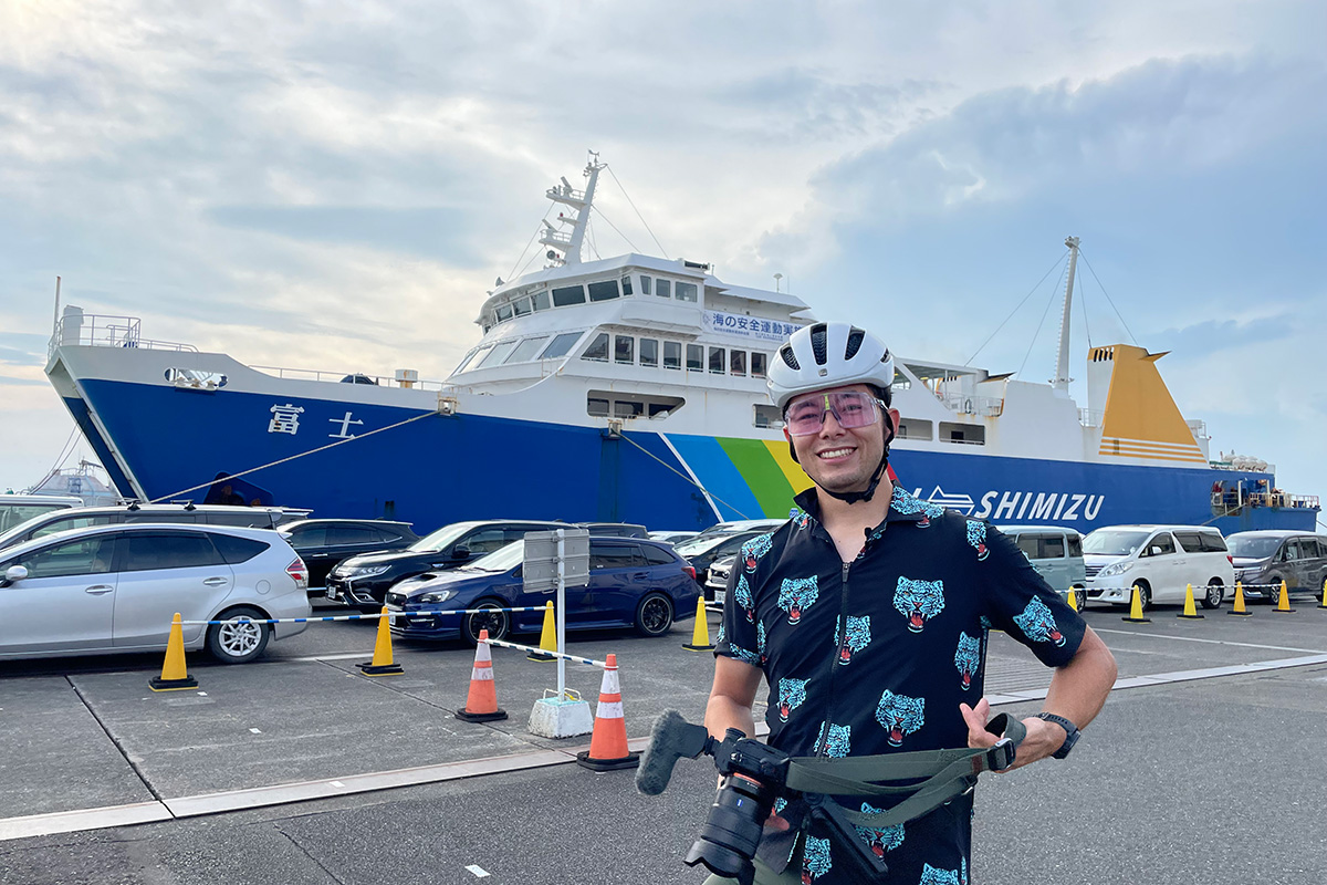
The journey begins at Shimizu Port
Suruga Bay Ferry Shimizu Port Terminal
For this trip, we chose Shimizu Port as our starting point for the Suruga Bay round-the-bay route (commonly known as "Suruichi"). We took the Suruga Bay Ferry across Suruga Bay to Toi Port on the Izu Peninsula. Next to the ferry was a line of cars waiting to board.
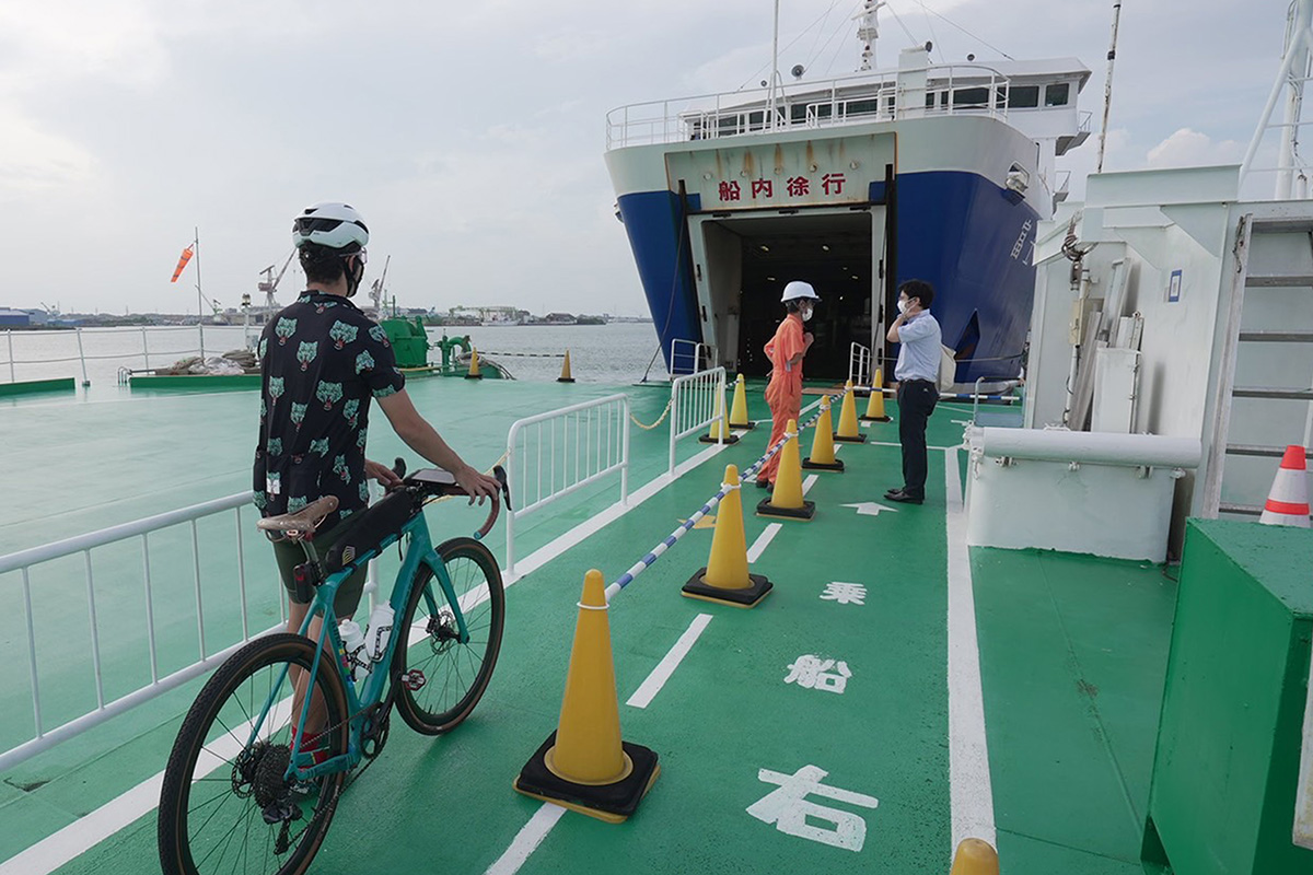
Now it's time to board the ferry!
Bicycles can be transported on the ferry assembled (500 yen per bike). The number of bicycles is limited to 8 to 16 per sailing, so it is recommended to make reservations in advance. Incidentally, bicycles can be brought on board free of charge if they are packed in a bike bag.
For more information
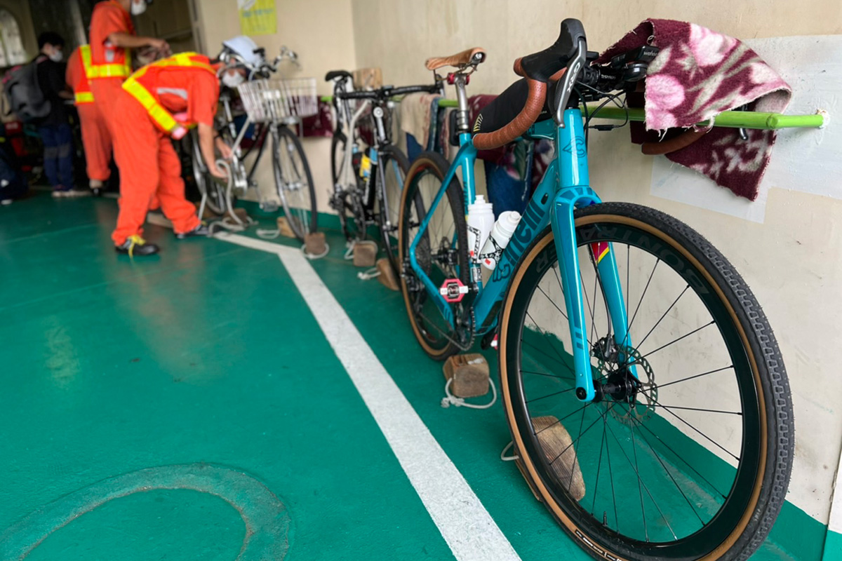
Securely holds bicycles in place
Relieved by the attendant's familiarity with the work
Push the bicycle by hand to the ship's vehicle deck, proceed, leave the bicycle with the attendant, and you are done. The bicycle will be carefully secured with a blanket to prevent damage to the frame.
Outgoing ferry
Departure from Shimizu Port to Izu Peninsula
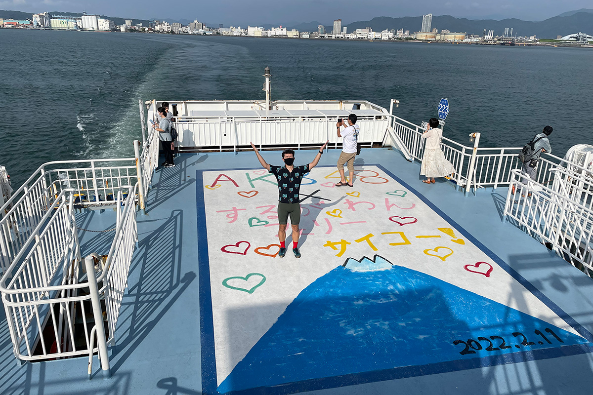
The first boat departs Shimizu Port at 7:45am for Toi Port on the Izu Peninsula! The beginning of the 75 minute boat ride. On the deck of the ferry were comments from the AKB48 members aboard and a picture of Mt. Fuji.
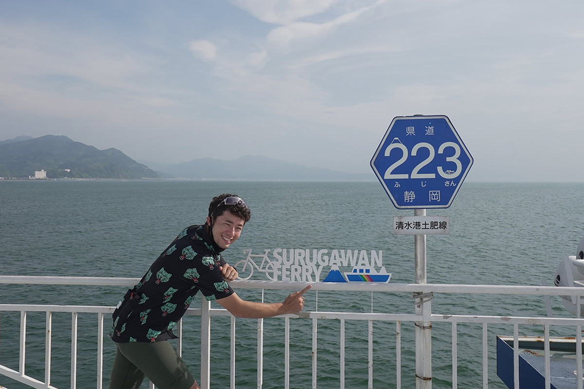
Suruga Bay Ferry's route is considered a prefectural road
Prefectural Road 223
A sign for Prefectural Road 223 (Fuji-san) is placed at the end of the ferry deck. In fact, the Suruga Bay ferry route (Shimizu Port-Tohi Line) is certified as a prefectural road of approximately 30km. There are other prefectural roads in Japan that include marine sections, but this Prefectural Road 223 is the longest in Japan. Behind the marker is a magnificent view of Mt. Fuji, but unfortunately we could not see it this time because it was overcast.
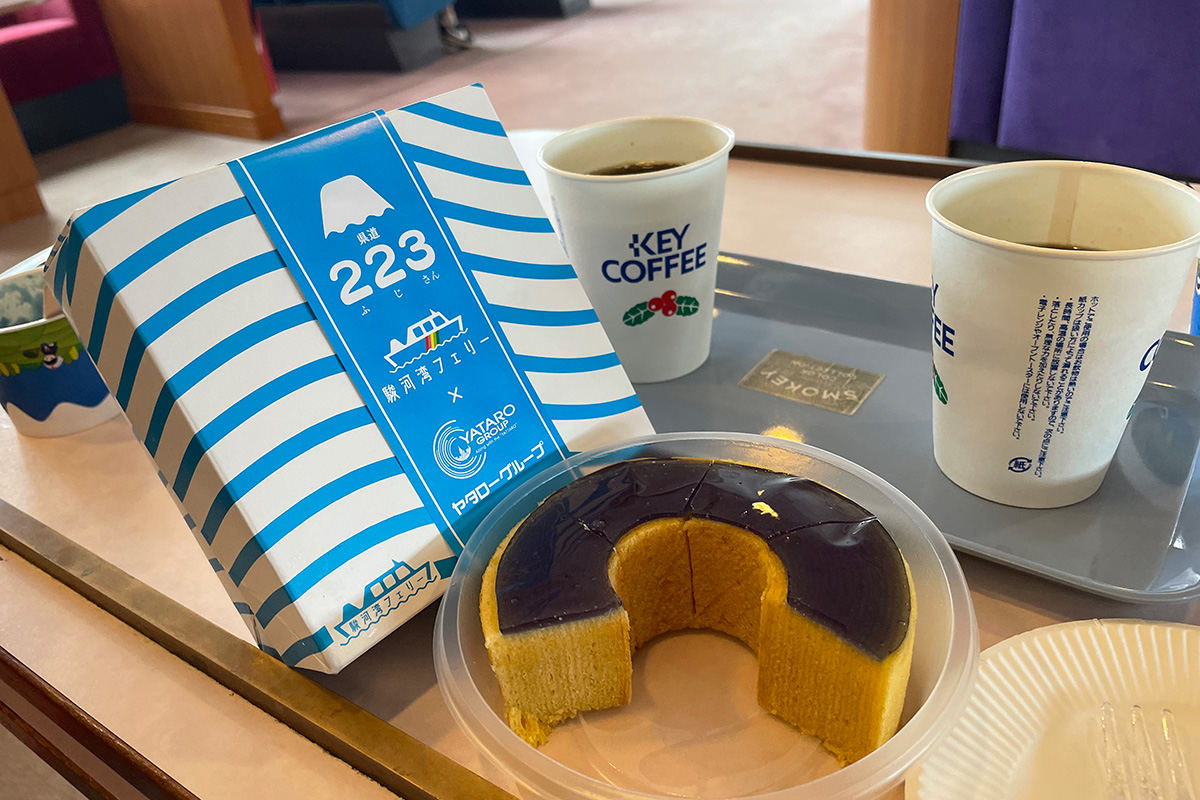
Original sweets to replenish energy
224 (Fuji-san) Baum
We hadn't eaten breakfast yet, so we purchased a baumkuchen (223 baum) at Ferry's Cafe on board. The baumkuchen is a collaboration with Yataro, a famous confectionery in Shizuoka. It is not too sweet, so the two of us finished the whole baumkuchen.
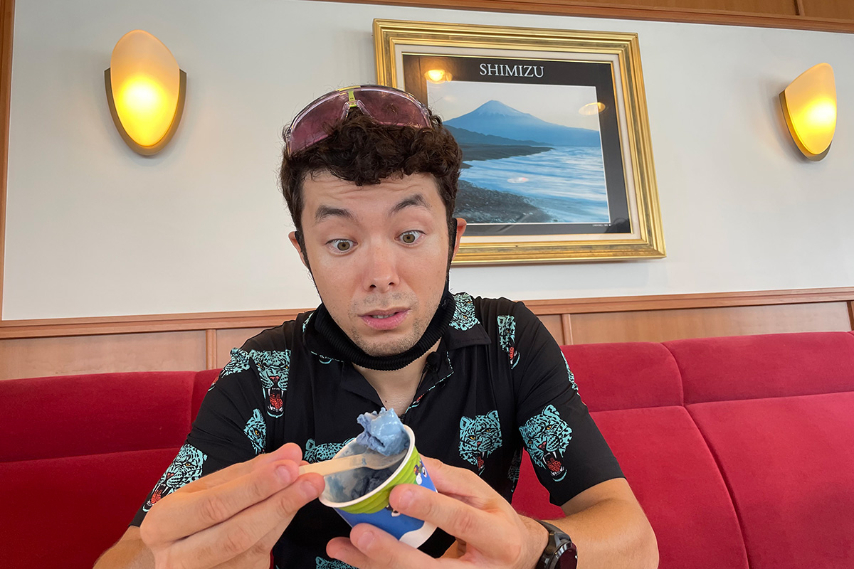
Original gelato to refresh your mind
Suruga Bay Gelato No. 223
I was feeling a bit seasick because of the strong waves that day. In order to raise my spirits, I ordered Suruga Bay Ferry's original gelato. This product is also a collaboration with Nanaya, a famous green tea gelato maker in Shizuoka. The blue gelato is inspired by the deep blue of Suruga Bay. It tastes like salted milk. It was also delicious with a moderate sweetness.
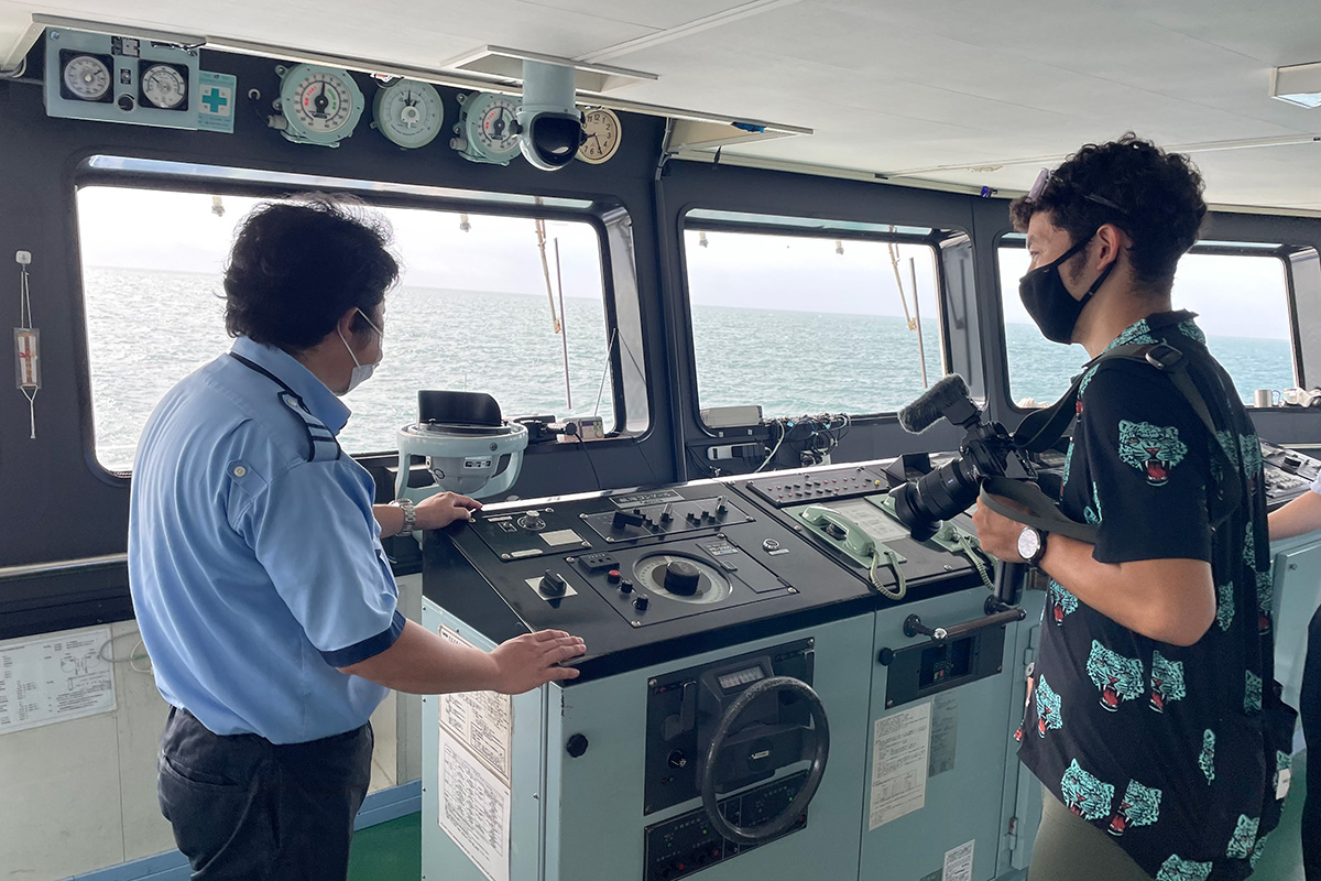
Special Experience! Visit the Ferry Wheelhouse
Question time for the captain
Luckily, I was offered a special tour of the ferry's cockpit. Gingerly, I entered the wheelhouse and asked the captain a few questions. Everything behind-the-scenes was new and exciting to me, but as I was asking questions about the equipment, my allotted time was over before I knew it.
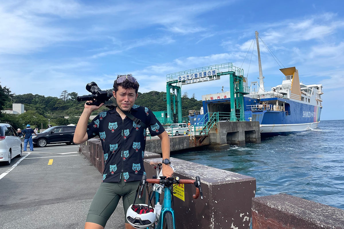
First time arriving at Izu Peninsula by ferry
Suruga Bay Ferry, Toi Port boarding gate
Before we knew it, we had crossed Suruga Bay and arrived at Doi Port on the Izu Peninsula. We disembarked with our bicycles and took a commemorative photo with the Suruga Bay Ferry. We were already feeling like we were in the second half of our trip, but then remembered that we still had 110km to go before nightfall.
This time, the ride starts.
National Route 136
What awaited us as we departed from Toi Port was a relentless uphill climb. We were still feeling a little seasick, so we diligently and silently started to climb the 560 meters from sea level right from the start.
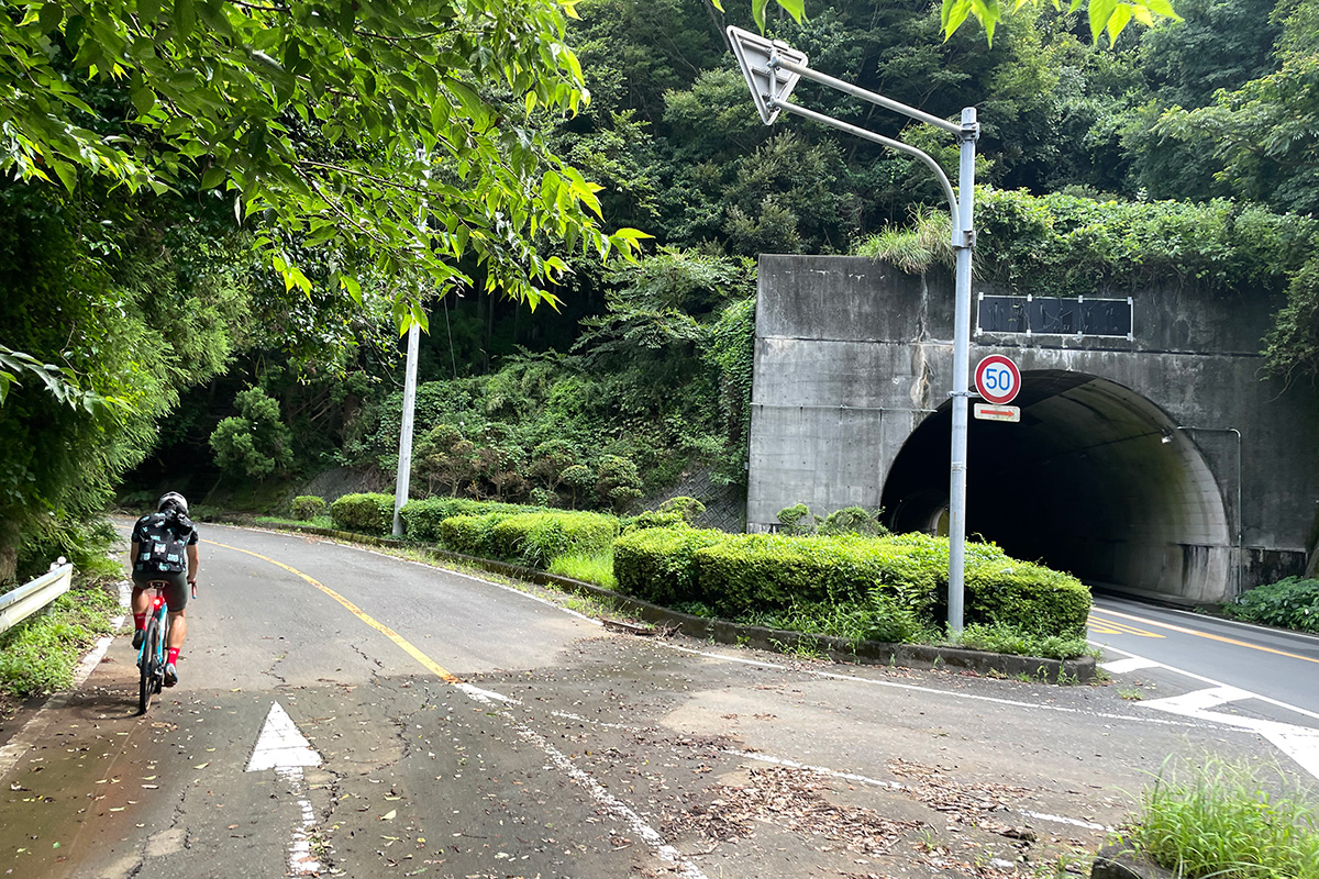
Driving on an old road with few cars
Old National Route 136
About 4km into the climb up the pass, just before the tunnel, we reached the junction with the old Route 136. The traffic was heavy on this national road, so we were very grateful for the old road (about 10km), which reduces the stress on cyclists.
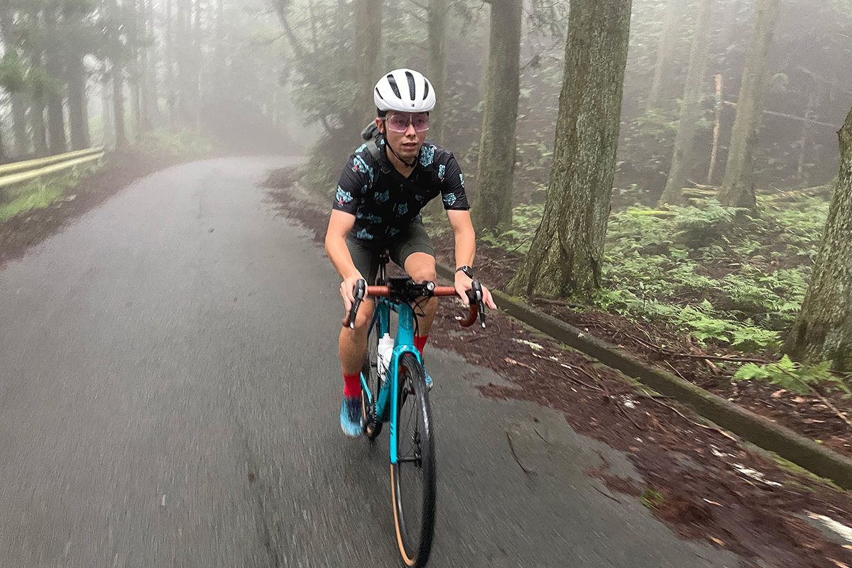
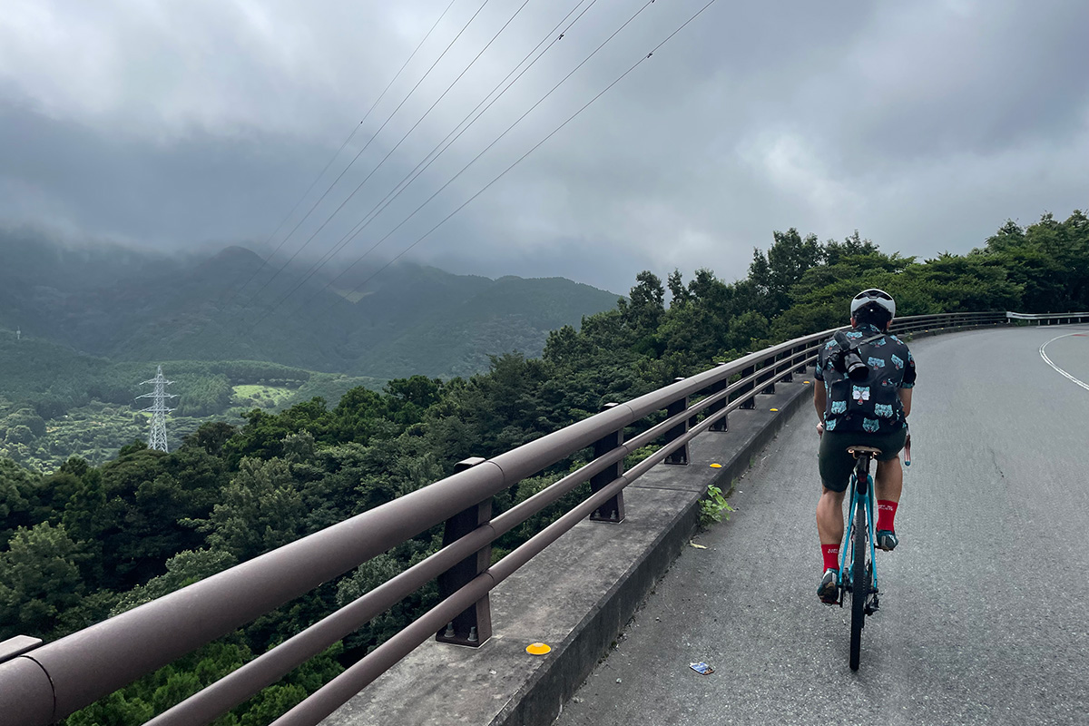
Sudden appearance of deep fog
Old National Route 136
As we rode along the old road and gained altitude, the fog began to roll in around us. We could no longer hear the chirping of cicadas, and we felt as if we had wandered into a strange world. Incidentally, we passed no cars on the road.
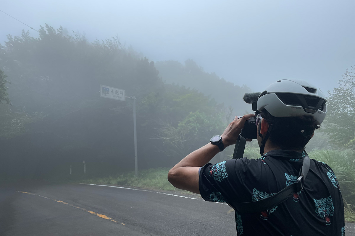
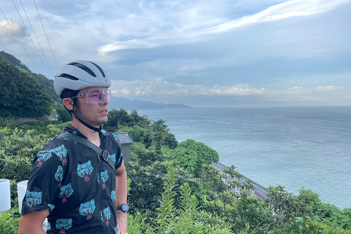
A mountain pass which let us forget the heat
Toi Pass
The temperature dropped due to fog, and we arrived at the Toi Pass without too much physical exertion. At Toi Port, the temperature was 34°C (93°F), but we noticed that it had dropped to 24°C (75°F), making us feel a little chilly. The sign for Toi Pass was only dimly visible through the fog. Bonus time for the descent, which lasts about 7km!
User Recommends
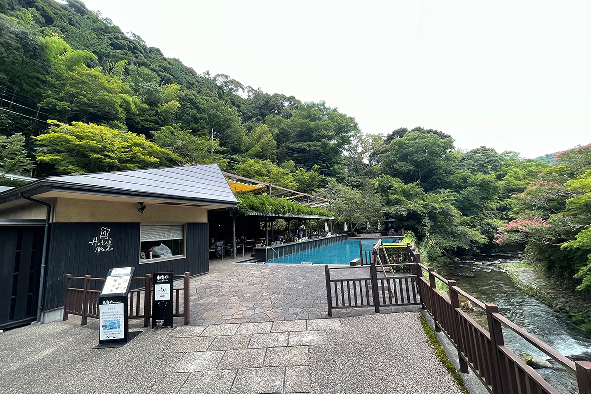
First aid station of the day
Bakery&Table Tofuya Ashiyu Cafe
About 20km into the ride, we took a load off at "Bakery&Table Tofuya Ashiyu Cafe" located in Yoshina Onsen, the oldest hot spring on the Izu Peninsula. Take an elegant drink break on a sofa in a secluded spot surrounded by mountains.
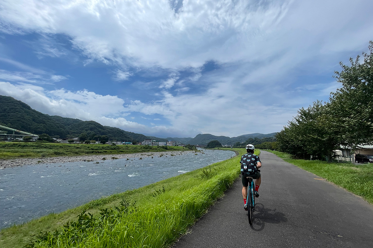
Speeding up with a tailwind
Kano River
We headed north along the Kano River, which runs north-south through the Izu Peninsula, toward Numazu Station. There is a 25-km bike path along the Kano River, and we were able to ride comfortably. Thankfully, we benefited from the tailwind, which increased our speed and preserved our stamina!
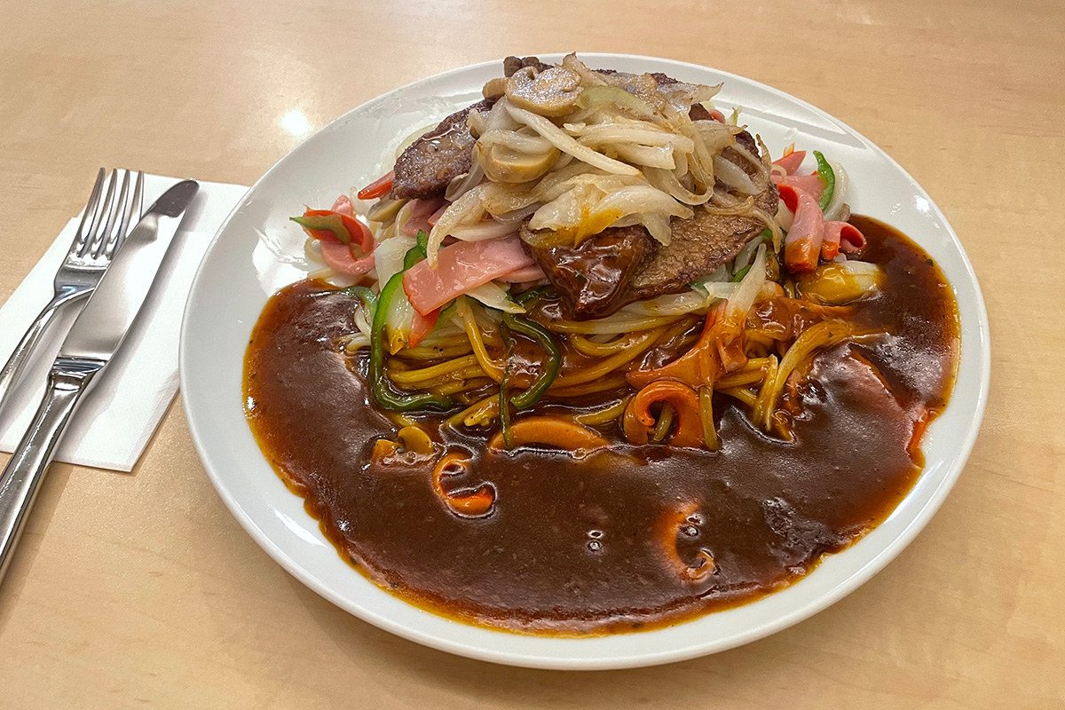
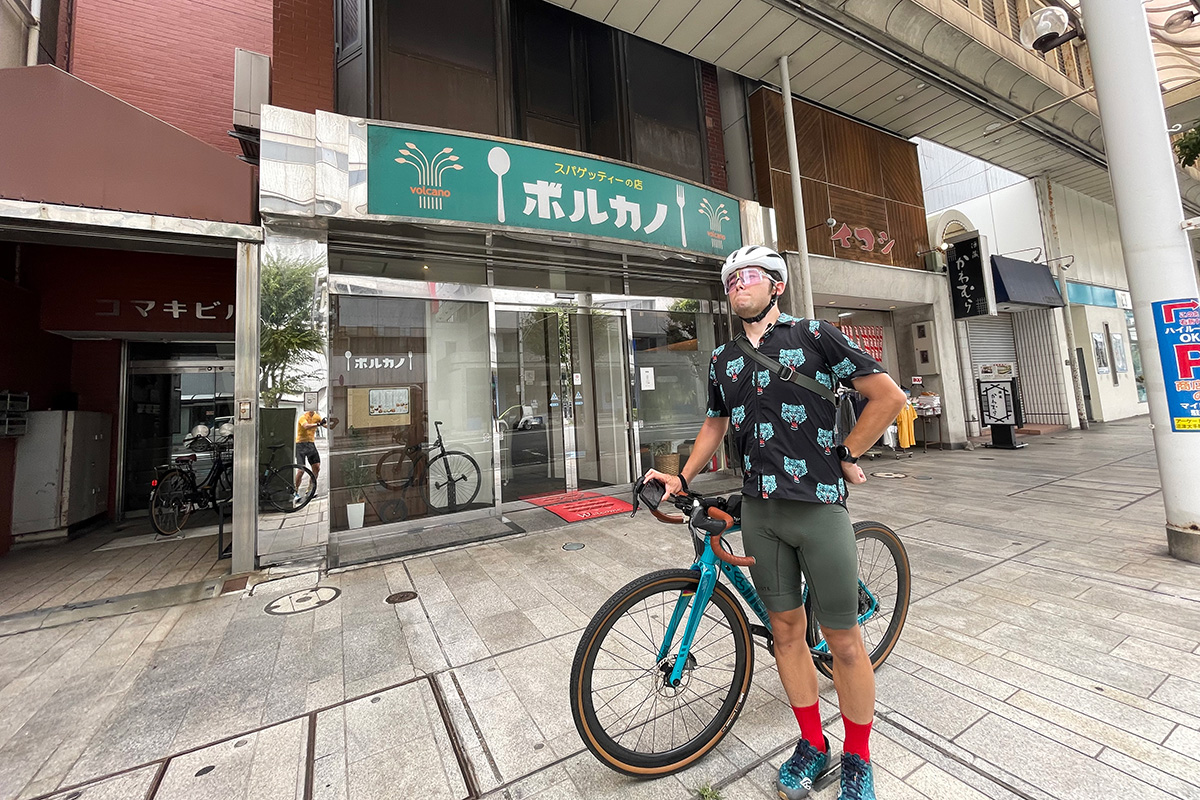
Discover new gourmet foods in Numazu
Volcano
Speaking of Numazu, one might expect to select seafood, but at the insistence of Tsucchi, an Ankake (= starchy sauce) pasta lover, forcibly led me to the restaurant named 'Volcano', a long-established pasta restaurant located near Numazu Station. The restaurant was busy with local customers. I recommend the liver topping!
User Recommends
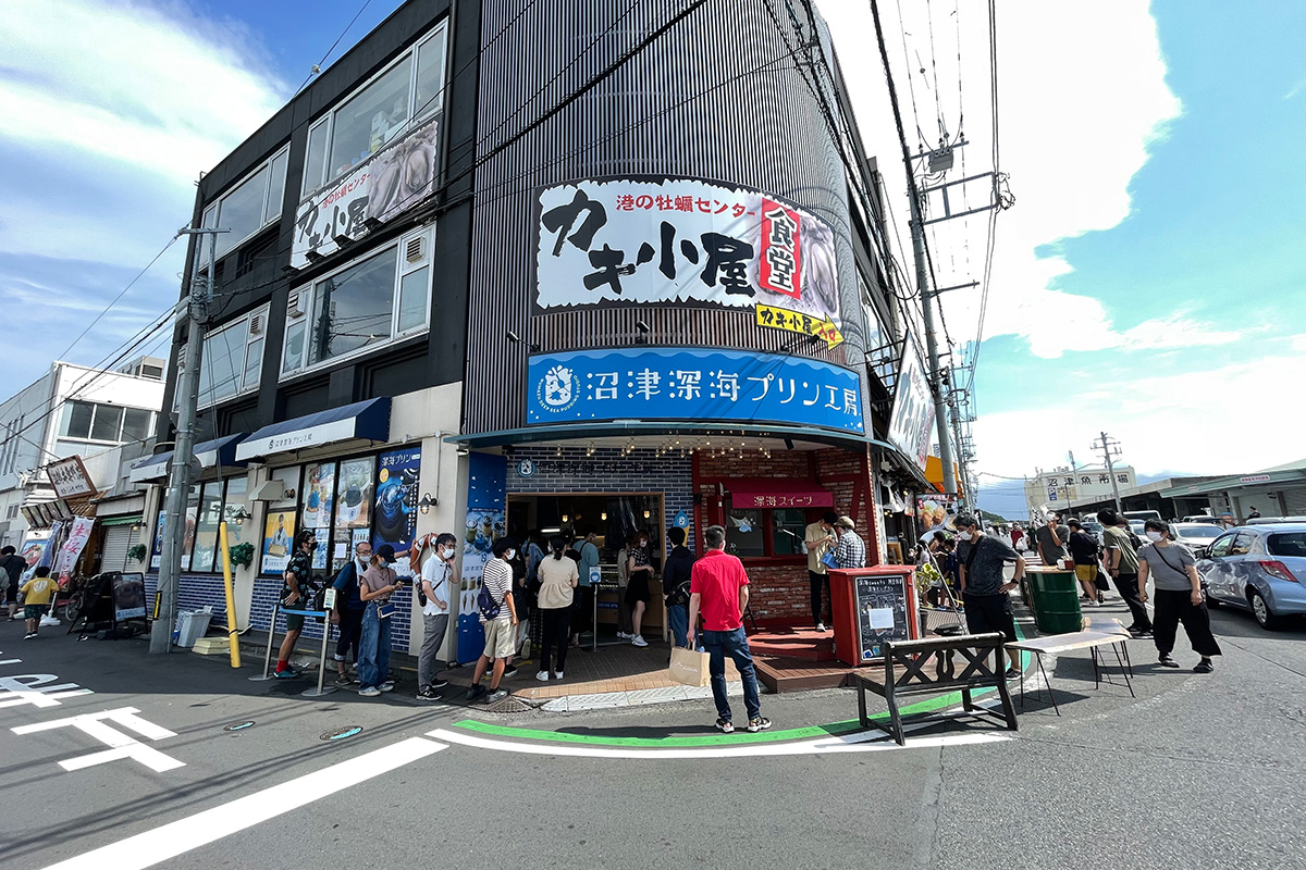
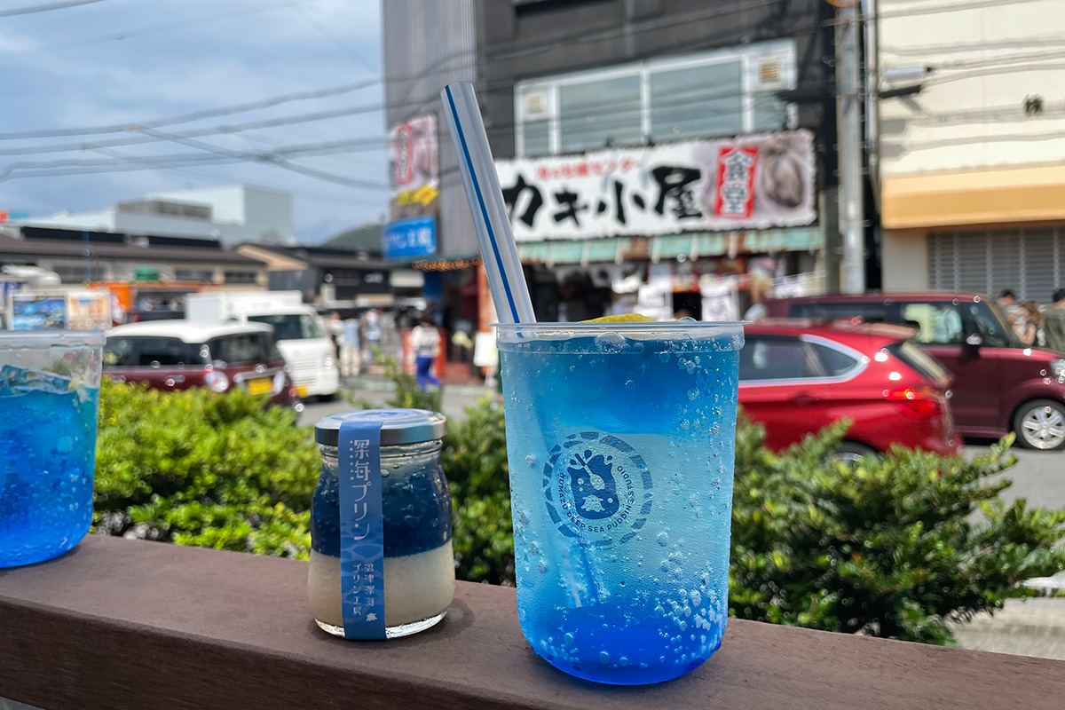
Pudding, this dessert is the talk of Numazu Port
Numazu Deep Sea Pudding Factory
We moved to Numazu Port, about 2km away from lunch "Volcano", for after-dinner dessert. We also purchased "Numazu Fukkai Pudding" (a must-buy when visiting Numazu Port) and "Be-dama Soda" (a summer-only drink). Both are bright blue representations of the deep sea of Suruga Bay, and look cool to the eye.
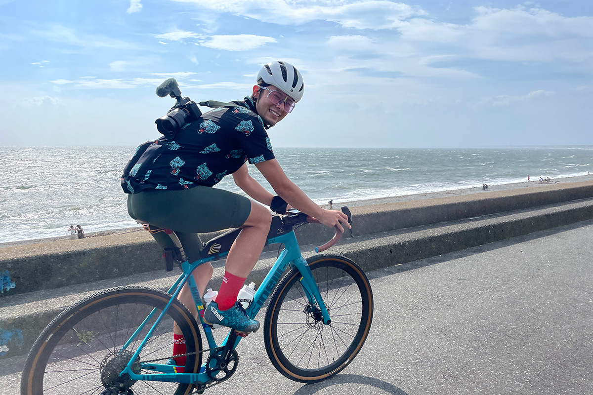
Strong sea breezes slow down the speed
Katahama Beach
After leaving Numazu Port, we drove along the embankment on the Katahama coast, only to have our way blocked by a strong crosswind blowing from Suruga Bay. The wind was so strong that it was difficult to ride in a straight line, so we gave up the route along the embankment and drove along Prefectural Route 380. We lost a lot of time and (especially) energy due to the strong sea wind.
User Recommends
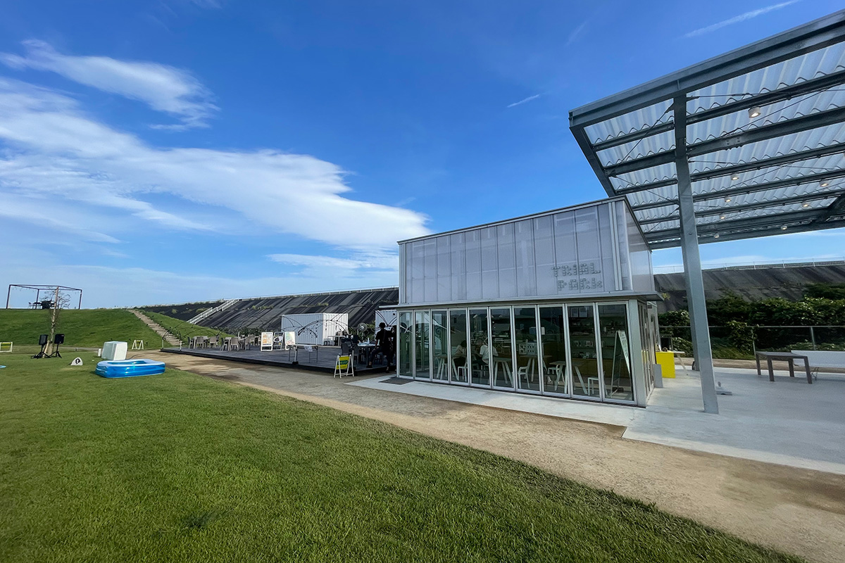
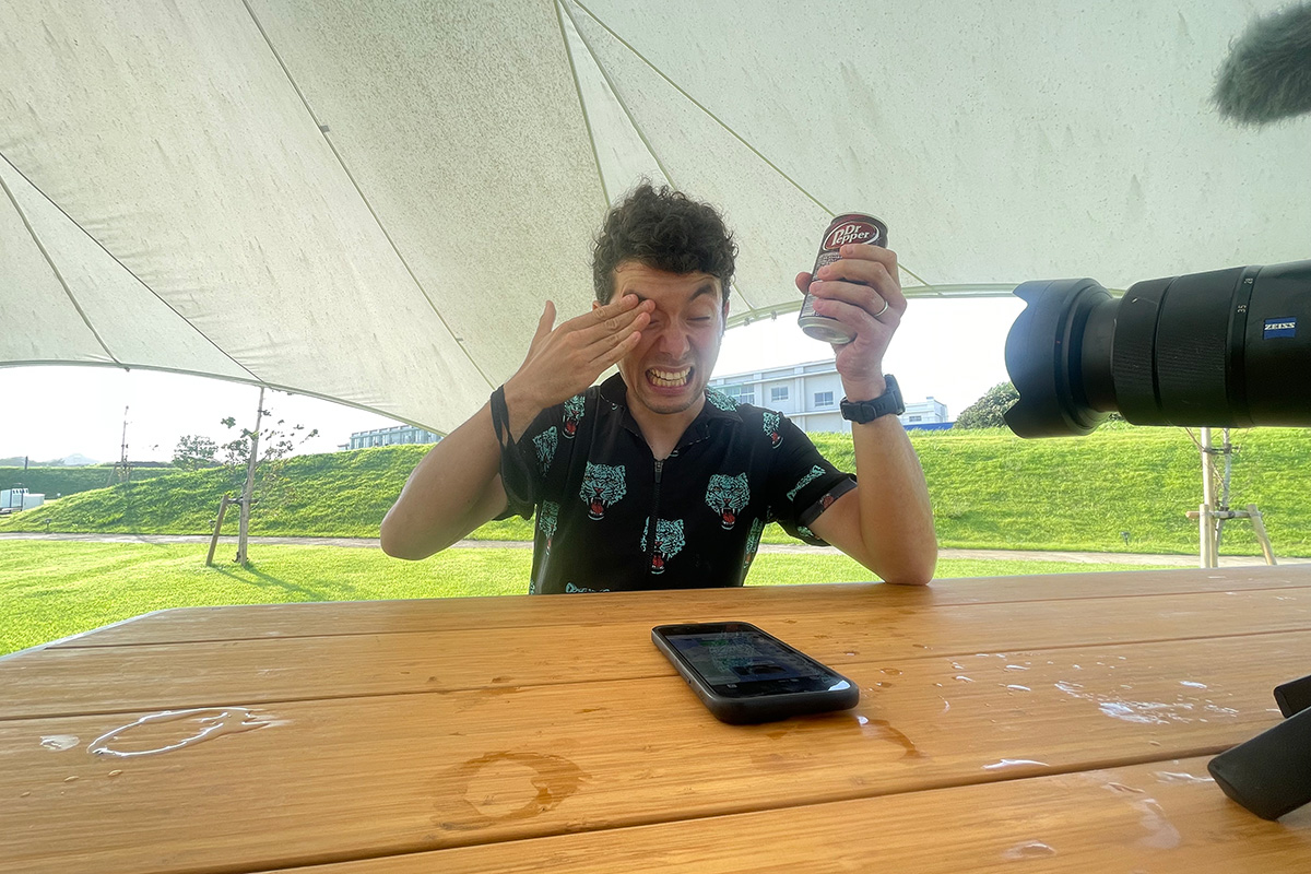
Carbonated drinks to restore power
Trial Park Kambara
The winds were stronger than we had imagined, and our stamina was sapped. We arrived at our last rest stop, "Trial Park," a facility that opened in June 2022 and is an experimental facility for private companies to try out new businesses. In a tent set up on a spacious lawn, we refueled with carbonated juice. We have 20km to go before we reach our goal at Shimizu Port.
User Recommends
Avoid Route 1
Avoiding Route 1 and one final step
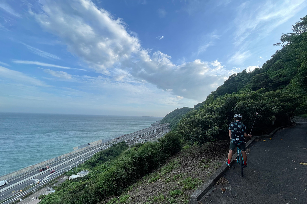
Satta Pass (Satta Touge)
In order to avoid the busy Route 1, we decided to go through the Satta Pass, which was said to be a difficult part of the old Tokaido Highway. The steep slope that suddenly appeared was truly a wall. Tsucchi and I couldn't help but laugh. However, the view from halfway up the slope was a spectacular spot from which we could see the entire Suruga Bay. It was the most spectacular point on the route this time!
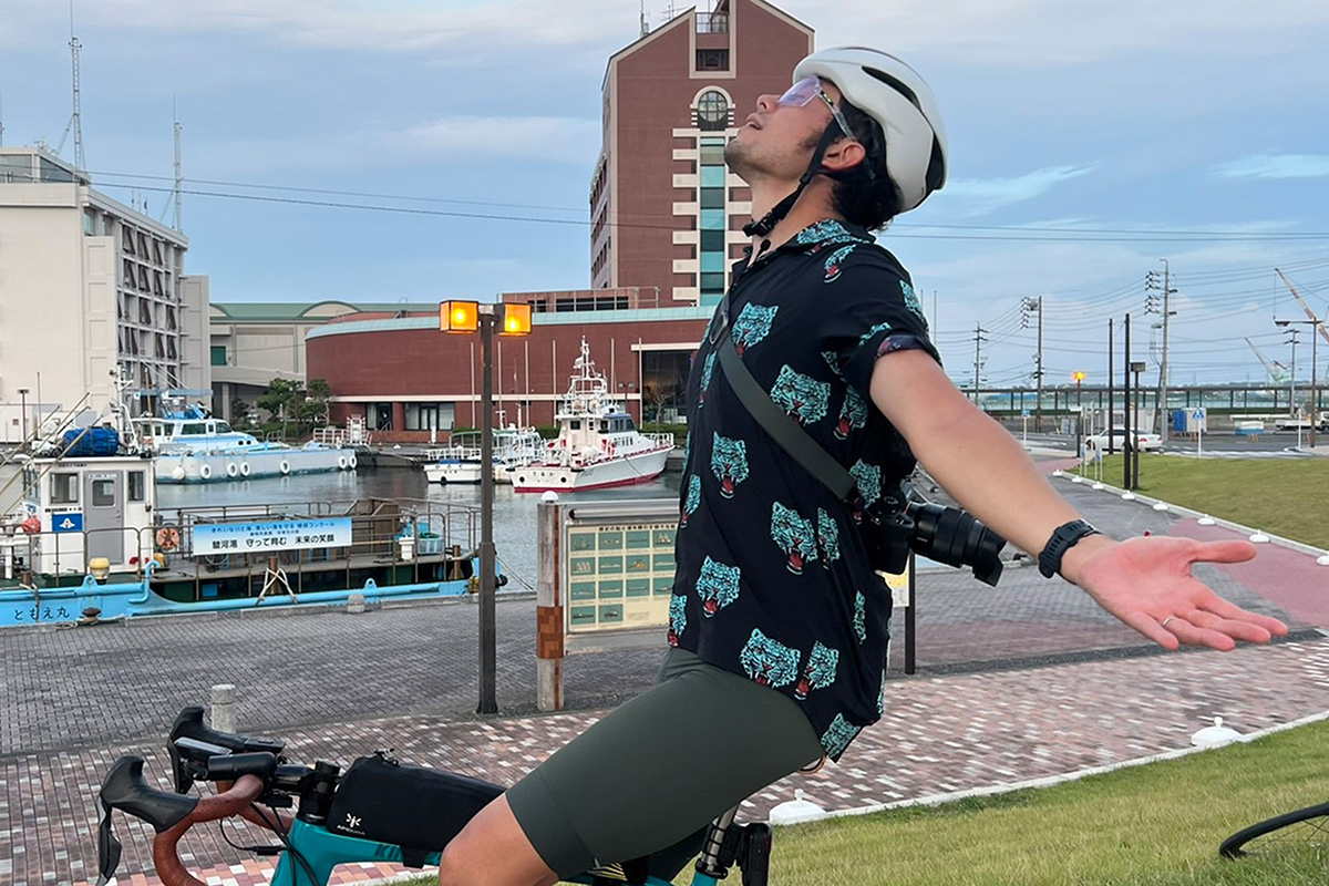
Shuichi achieved!
Shimizu Port
Starting with a boat trip on the Suruga Bay Ferry, the 110km ride was full of variety, taking in the Toi Pass, the Kano River, the coastline, and the Old Tokaido Highway. I was so satisfied with the richness of the ride that it seemed like yesterday when I boarded the ferry. By incorporating the ferry into the route, I was able to find a different way to enjoy the Izu Peninsula.